Showing posts with label Unit X. Show all posts

Wednesday, 16 May 2012

Our Final Film

This is our final film exhibiting our final piece.
We collaborated with Tom Valentine, an Interactive Arts student who is also doing the Unit X project.
I'm very happy with the film as I feel it doesn't overwhelm the viewer with lots of miss-matched photos, or too many ideas and unnatural effects, however portrays our idea about the spreading of germs and disease throughout Manchester during the Industrial Revolution, resulting in a destructive outcome. I think the video works as its quite haunting, especially with the movement of the shadows in the background. 


Stop-Motion Film


This is the stop-motion film I had prepared for by creating large-scale maps to apply finger prints to.
I decided on this maps as it has good positioning and shape and uses one of our main colours, red. We applied the finger prints using blue acrylic paint, as blue was another of our main colours we used.

Tuesday, 15 May 2012

Large scale map #4

This is the final map I drew on to fabric. I used more positioning on this sample rather than pattern:

Saturday, 12 May 2012

Working on mannequin #2

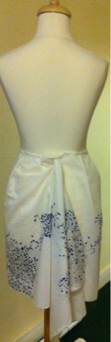
I have experimented with my large scale map#2 to see how it would look on the body:


I really like this sample above because I think its a really strong structure, and shows off the maps of old Manchester in a modern way. However, for our final piece I understand it needs to be more old-fashioned style. So I created this one:


I tried to create the old- fashioned style with pleats but made it a little more modern at the back, instead of visible buttons.

Friday, 11 May 2012

Large scale map #3

I think this is the sample that Sonia and I will use to create a stop-motion film of footsteps on to the map:

Large scale map #2

I have carried on my idea of creating large hangings of fabric with maps hand-drawn on to them, using placement and colour carefully. To possibly use in the final piece. In this sample I used blue fine-liner to colour in the map, in way that could show population of people.. Or germs... Spread slowly:

Thursday, 10 May 2012

Kathy Prendergast

Another artist who uses maps in their work, is Kathy Prendergast.
These maps below, on first glance without knowing any background details about them are similar to my work.


After a little more background research, I found Prendergast's 'Lost Maps' work (below), which looks like an ordinary map of the United States, however on closer inspection, it reveals that all the names of places have been removed from the map except for those that begin and end with the word lost (e.g., Lost Creek, Lost Island, and Lost Canyon):


Although I am happy with the work I am doing with my maps, and am including concepts behind them, work such as Prendergast's makes me want to work with maps again and try out more ideas. 

Wednesday, 9 May 2012

Working on to a mannequin

Following my work with prints via photocopying and hand-drawings, I thought it would be good to see how the pieces looked on a mannequin, as improvised garments, or parts of garments, to possibly use in our final piece. 


I enjoyed doing this task, it's good to see how this piece looks a a dress, gathered, pleated and draped. As a group we have often talked about perhaps using draping fabrics as background, or parts of a garment, so I did a piece to portray a sleeve draping down:


I am happy with this piece even more so now, and look forward to carrying out more, similar samples.

Progression of large-scale map

After creating my large-scale hand-drawn map, I decided to add colour with embroidery to show the idea of a journey through the map. Perhaps the speeding of germs through Manchester. I used the colour red because it links in with the other people in my group's working too, as we have decided red and blue are our main colours.


I am really happy with this sample, and will use a mannequin to model it as different parts of a garment. I also hope to make more large-scale samples like this, maybe with different patterns and other uses of colour. 

Guillermo Kuitca

I have decided to look at other artists who use maps in their work.
Guillermo Kuitca uses maps as metaphors for human relationships, as you an see in the examples of his work I have shown below. He always uses political, psychological and social reference in his work, no matter how abstract.


Monday, 7 May 2012

Photoshop prints

Over the bank holiday weekend I used photoshop to make patterns from the maps I have drawn, and already used by photocopying. I thought I was a good idea as it is easier and faster (technically) to experiment with colour and pattern, including repeat pattern and placement.


I can't decide if I like these prints. I think some would look better on very thin material, perhaps for use for a scarf design. However, I prefer my photocopied and hand-drawn designs, I feel they are more organic, and the motifs are stronger on them.

Tuesday, 1 May 2012

Pattern-making with Maps: Progression with colour and repeats

Following a productive printing session, I used the facilities on campus to photocopy four of the prints that were a reasonable size, on to tracing paper. Because I don't think I have the facilities to apply my prints to fabric, I hope I can create some interesting ideas using tracing paper, here are the designs as more repeat patterns:


On the outline maps (last two) I experimented with colour, although it took a long time. I will photocopy them in colour and proceed to work with these on a mannequin and photoshop.

Monday, 30 April 2012

Pattern-making with Maps:

Following a tutorial this morning in which we realised how little time we have left, I got straight in to the flow of Monday Morning work and decided to apply the pattern I did last on to iron-on transfer paper. Although easy to apply to the paper itself, it was NOT easy to apply to the fabric, in fact, it didn't work at all, except the accidentally-photocopied binding of my sketchbook:
I decided I didn't want to waste the fabric, so I used a fine-liner on it and created the maps myself, using the whole length to create a path of maps:
I'm really happy with this, although it didn't go to plan, I think I made the best out of a bad situation, since the fabric with be used as part of an installation, it doesn't have to be created in a practical manner.
I then carried on using the same map to photocopy, fill in, and create more patterns:


I am pleased with all of these patterns, and hope to print on to tracing paper, to create more samples.

Working with Maps:

In addition to re-creating the maps of Hulme and the city centre of Manchester, I decided to work with the maps a little more, I could already see patterns in the maps, so used this map of a very small part of Hulme:
.. and repeated it randomly and came up with this:
I wanted to place the map so it appeared to start off somewhere on quite a large scale, and then spread over to another part of the page. I then photocopied it several times and reduced the size of it, creating a pattern:
I really liked this idea and decided I would work with it some more.

Monday, 23 April 2012

Further Sketchbook Work:


After a confused Easter holidays, I found our first tutorial back quite inspiring. Due to a suggestion at the beginning of the project from Alex Russell, I decided to look at maps of different parts of Manchester, whilst others in the group looked at the spread of germs and disease which came from the over crowding of Manchester during the Industrial Revolution.
First I looked at the more Industrial areas of Manchester, around the City Centre:

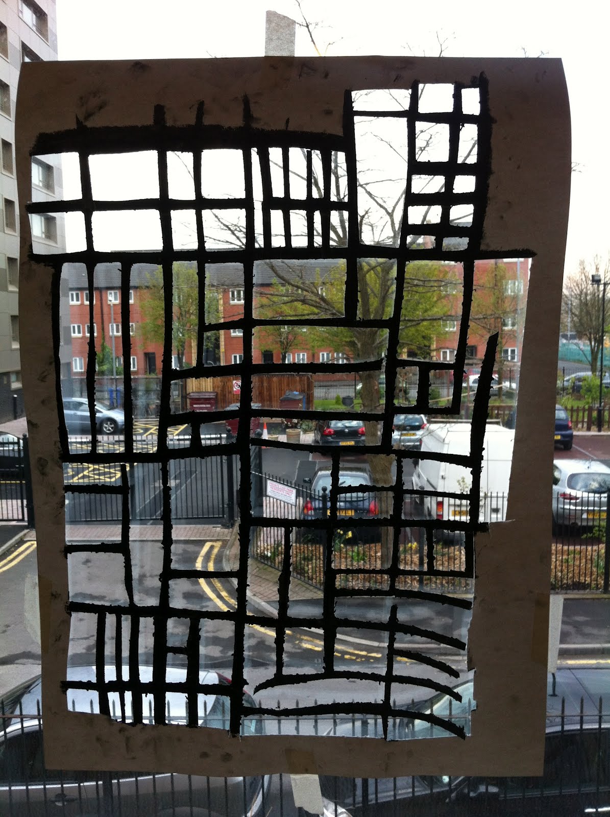
I then did a series of drawings from these maps, including blind drawings, continuous line drawings and negative drawings:

I decided to look at an area which has always been residential, to show the idea of over crowding better:
HULME:

I continued my idea from earlier of using different techniques, however I layered drawings, and also used colour differently, whilst creating larger scale versions to imagine them as patterns:


I then created A2 versions of the maps, using home-made paint brushes (attached to a 50cm pole), ink and cut outs: